© Historic Charleston Foundation
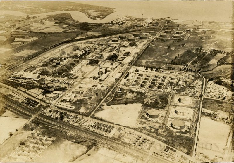
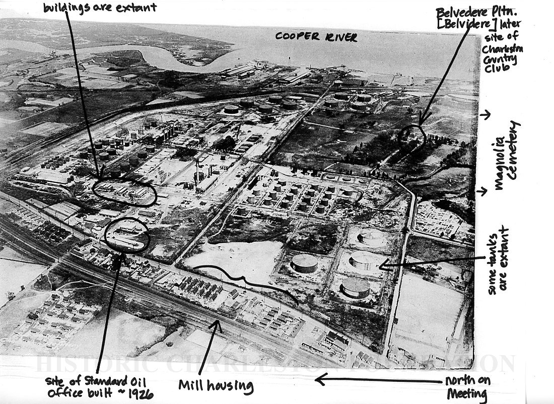
Aerial photograph of the Standard Oil Refinery, which was located north of Magnolia Cemetery, bounded by upper Meeting Street on the west. Shows the tanks (some of which are extant), industrial buildings, housing units, Belvidere Plantation (also known as Belvedere Plantation), and other buildings (some of which are extant). Also shows Laurel Island (upper left) and the Cooper River (background).
The photo, which appeared in the Evening Post newspaper on April 29, 1926, is captioned: "The air view shows the big refinery established by the Standard Oil Co. on the Cooper river several years ago, there being seen the stills, storage tanks, various buildings, athletic grounds, and the former country club and other property recently added to the territory covered by the extensive plant."