© Historic Charleston Foundation

Nineteen ca. 1940s B&W photographs of buildings and street scenes in Charleston and vicinity.
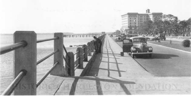
a: Looking west on Murray Boulevard from the bend at East Battery. Edge of White Point Gardens in view at right; Fort Sumter Hotel (now known as the Fort Sumter House at 1 King Street) in background. Cars are on the road.
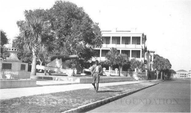
b: Looking north on East Battery Street from near the bend at White Point Gardens. Pedestrian is walking by White Point Gardens. Louis Desaussure House (1 East Battery) at center; Missroon House (40 East Bay Street) in the distance.
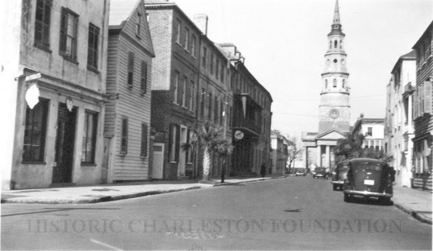
c: Looking north on Church Street from Chalmers Street. Features buildings on the west side of the street: 127 Church, 129 Church, 131 Church, and the Dock Street Theater). Also in view are buildings on the east side of the street: 18 Chalmers Street, 132 Church Street, and St. Philip's Church).Cars are parked on the street.
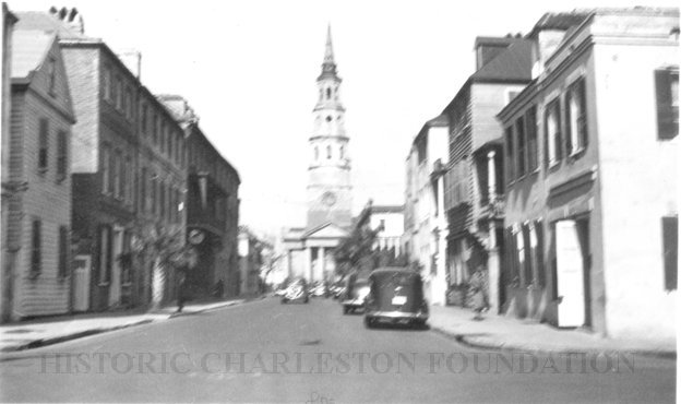
d: Looking north on Church Street from the northeast corner of Chalmers Street. Features buildings on the west side of the street: 129 Church, 131 Church, and the Dock Street Theater). Also in view are buildings on the east side of the street: 18 Chalmers Street, 132 Church Street, and St. Philip's Church).Cars are parked on the street.
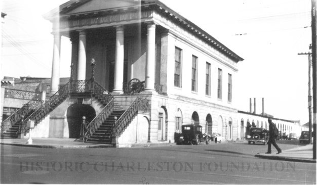
e: View of Market Hall, southwest elevation, including market sheds, and the corner of Market and Meeting Streets. Cars on street and pedestrian crossing the street. Cravens Delco Radio [store] on North Market Street at left.
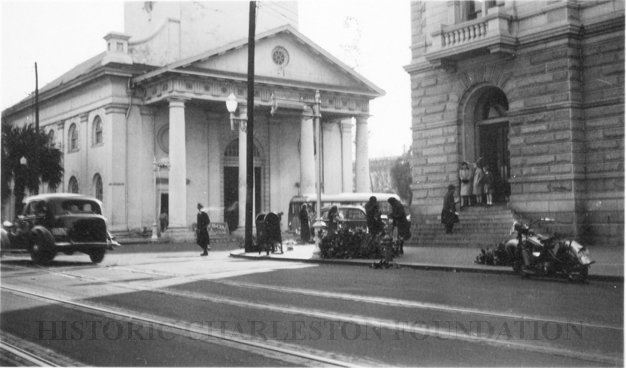
f: Scene on Meeting Street just south of the "Four Corners of Law" on Broad Street. Features the Federal Courthouse and Post Office and St. Michael's Church in foreground, and the County Courthouse and City Hall in background. Numerous cars are parked in front of the Federal Courthouse, with pedestrians on the sidewalk.
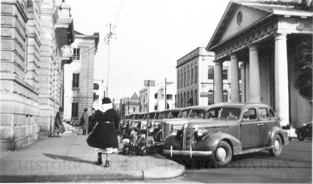
g: View of the intersection of Broad and Meeting Streets, featuring the Federal Courthouse and Post Office and St. Michael's Church. A car, motorcycle, and bus are on the street the street. Also shows pedestrian activity.
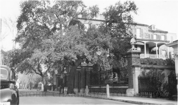
h: Looking north on Legare Street at 22 Legare Street (Charles Elliott House), a portion of which can be seen in the foreground (right). Man gathering leaves on the sidewalk. Car parked in background.
i: Looking north on Legare Street at 14 Legare Street (Simmons-Edwards House a/k/a Pineapple Gate House), gates in foreground (right).
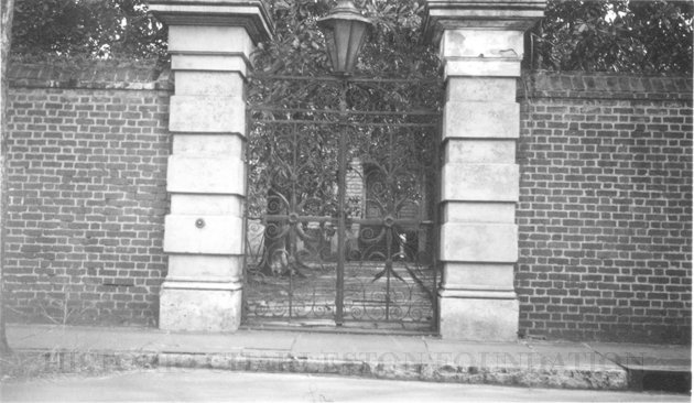
j: View of the Sword Gate (32 Legare Street).
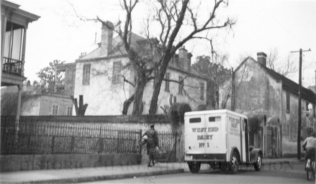
k: Looking west on Tradd Street at the outbuildings of 32 Legare Street (Sword Gate House). West End Dairy truck parked on street. Pedestrian on sidewalk and person riding a bike on street.
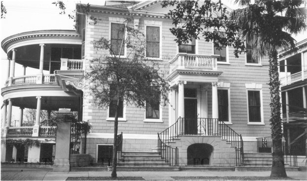
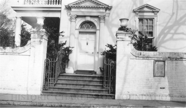
l: 15 Meeting Street (John Edwards House), street (front) elevation.
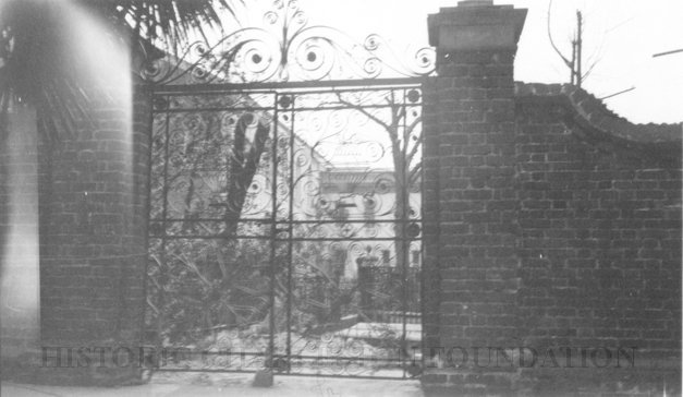
m: Gate of the Robert T. Chisolm House (23 Legare Street), a/k/a Sass Gate.
n: Gate to Washington Square Park. Daniel Ravenel House (68 Broad Street) in background.
o: Doorway of the Col. John Stuart House (106 Tradd Street).
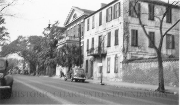
p: Looking west on Broad Street at 110 Broad Street (Bishop Northrop residence a/k/a William Harvey House a/k/a Ralph Izard House) and 114 Broad Street (Col. Thomas Pinckney House). Cars parked along the street.
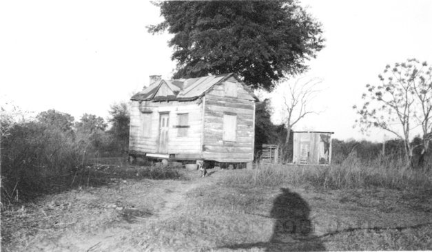
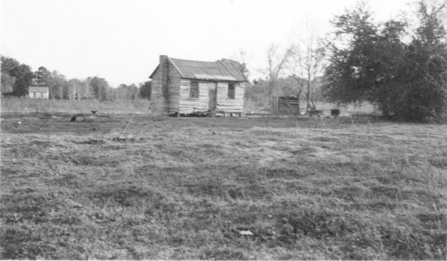
q: Small wooden dwelling, possibly a former slave cabin. "Negro hut" written on back of photograph.
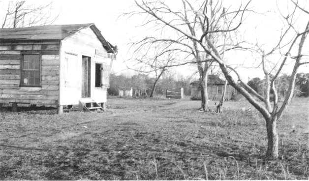
r: Small wooden dwelling, possibly a former slave cabin. "Negro hut near school" written on back of photograph.
s: Two wooden structures described on the back of the photo as: "School etc. on way to Frenchmans(?) house. [Illegible] on right hand corner of building."